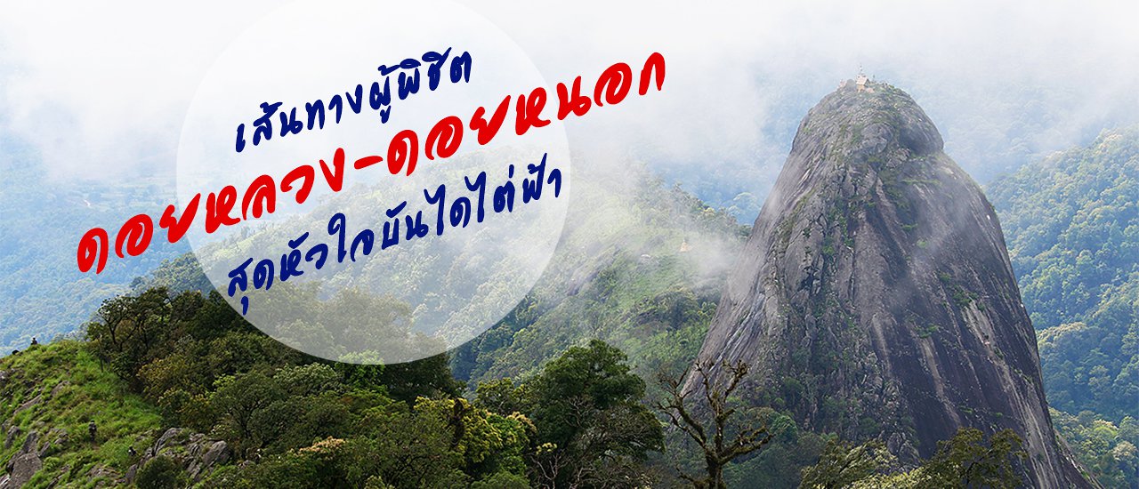
Doi Luang - Doi Nok... Previously I wasn't aware of where it is in Thailand map until I saw a feed on Facebook inviting people to visit there. I was like being put under a spell, I replied " I want to join" although this is my first time hearing its name.
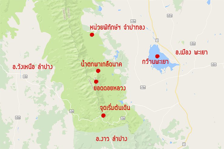
From that post, we eight people joins as a team to conquer Doi Luang-Doi Nok which is located in Doi Luang National Park. The National Park office is in Chiang Rai Province but the top of Doi Luang-Doi Nok is in Muang District, Phayao which is near Ngao District, Lampang Province under the care of Forest Protection Unit 6 (Jumpathong). Usually the National Park opens for visit from 1 October - 30 June with a short break during the heavy rain season. Our plan is to close the mountain, from 29-30 June. It's in the middle of the week, so we are the only group here. It's like we own the entire mountains.

It is noticed that traveling to Doi Luang-Doi Nok, we must have the National Park staff as the guide. For the pick up-drop off services, Look Hab (people who carry our luggage to the mountain), and other expenses, we need to contact the Forest Protection Unit staff directly at tel: 092-713-2046, 080-853-6033
For us, the one who initiates this trip has contacted everything and we just need to meet up in front of Phayao Bus Terminal.
- On the Way Up to Doi Luang -
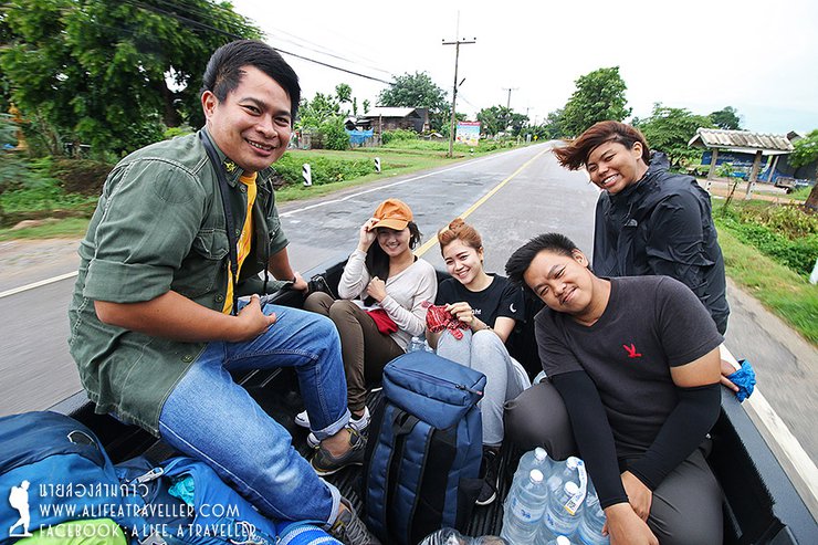
I travel by the bus from Korat to reach Phayao at 6 a.m. I find that only six of us are here due to one is sick and the other is busy. The funny thing is the one who invited us is one of the two absences.....That's alright, we six people must move on. We are three males and three females.
We find something to eat at the Bus Terminal while familiarizing ourselves to one another. The National Park staff drives the truck to pick us up at 7 a.m. We don't know which road we are going as no one has yet been here. Then, we stop at the scenic Gwan Phayao (Phayao Lake) at Ban Mae Na Rue to find the sign towards the conqueror of Doi Luang-Doi Nok. We repack our bag, go use restroom and inform the staff when we are done. Then, the staff said.....let's keep moving.


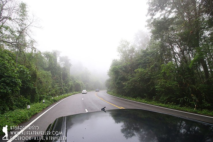
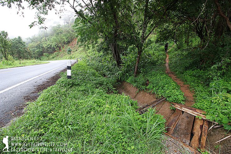
In fact, there're several routes up to Doi Luang-Doi Nok from Phayao and Lampang. Ban Mae Na Rue is the latest route with approximately 12 km long and quite difficult to walk. The usual route for the tourists is closed to Ban Pak Bok, Lampang, which is the joint of Phayao-Lampang Province. It is only about 5 minutes drive from where we stopped for the restroom.
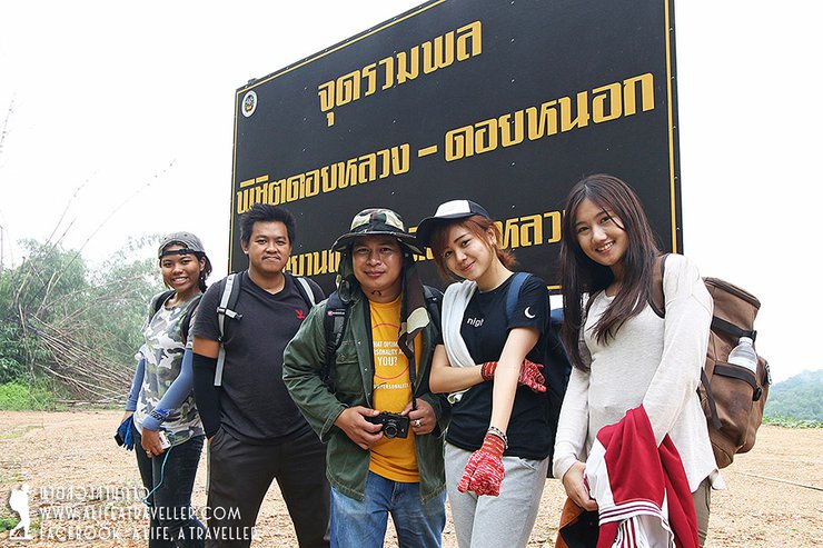
We take the photo at the walk up point at Ban Pak Bok for a memory as this might be our last good looking photo (haha)....This trip is quite fun as one of the girl is just graduated while the other two are still studying.

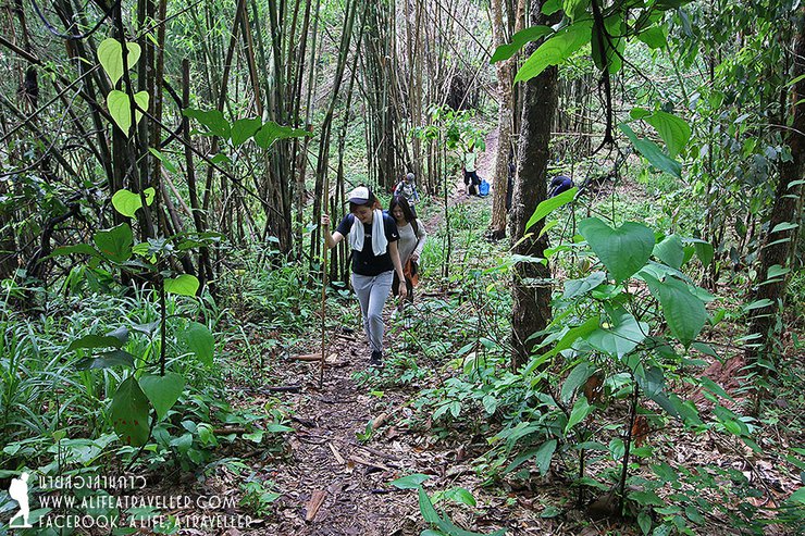
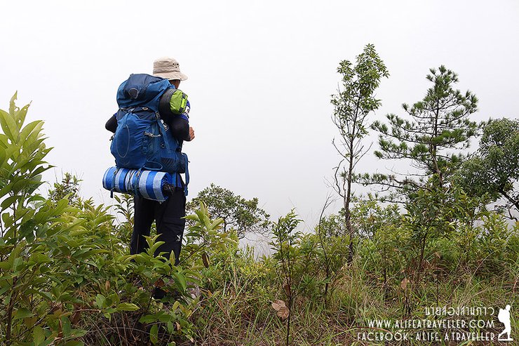
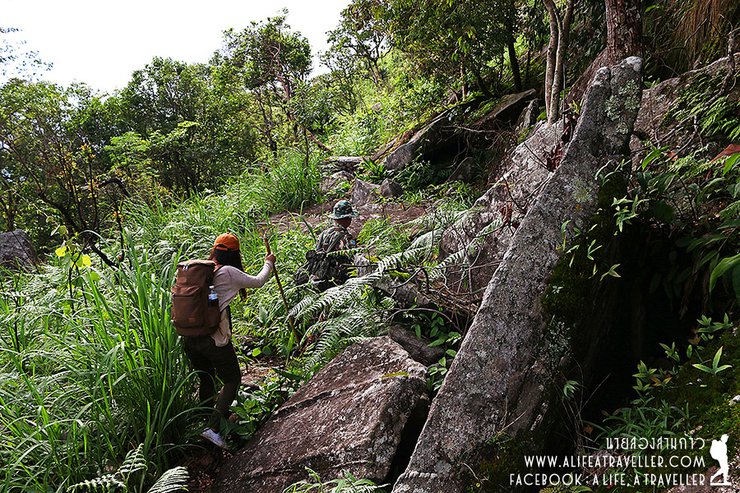
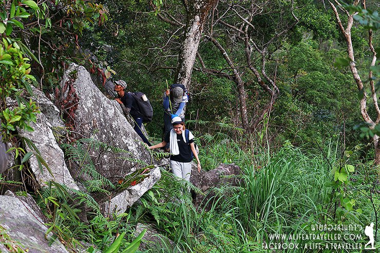
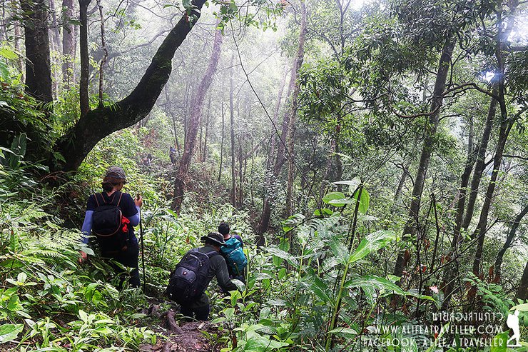
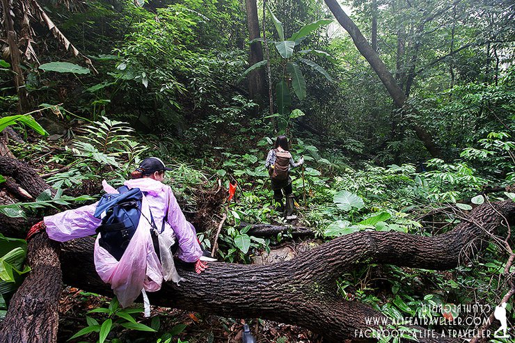
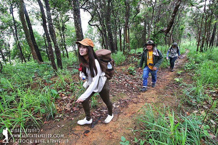
The starting point is right next to the main road. We start walking at 8.30 a.m. with a guide and two Look Habs who help a great deal in carrying our luggage. For me, I'd like to challenge myself so I carry my bag myself, let's see if I can make it or not.

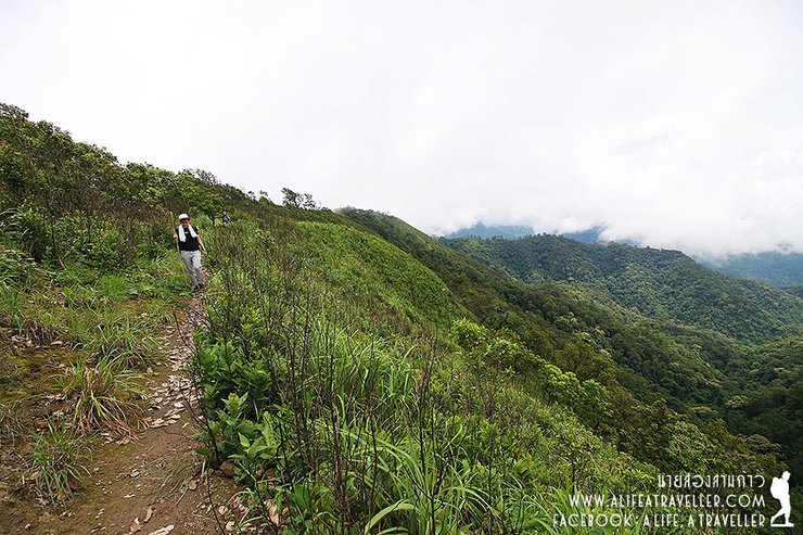
The first part of the route is quite ok. It's like we are walking across each mountain; we walk up and walk down, not only walk up like some mountains.

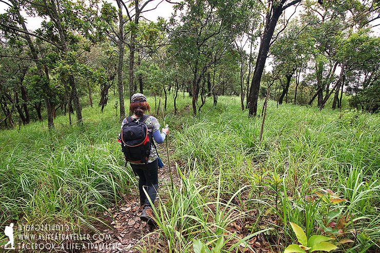
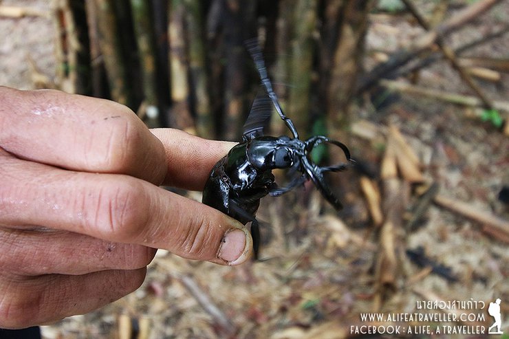
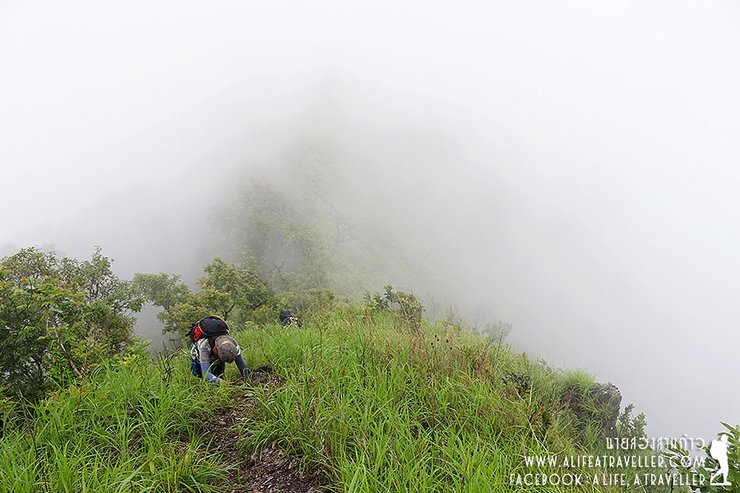
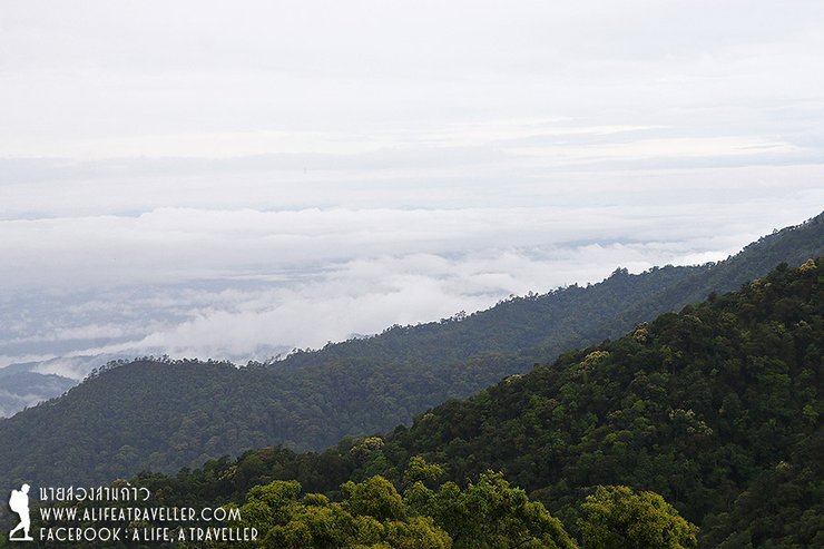
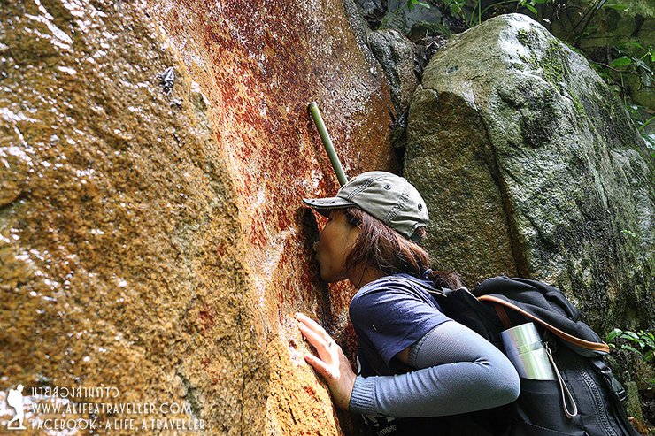
When we start to walk up more, I see this beautiful mist. Many things are also waiting for us to appreciate along the way.
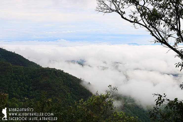
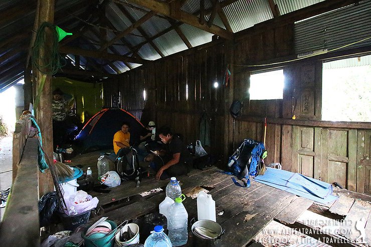
But when we keep going up, the mist is all over the place. When we reach our lunch area at the pine forest (Look Hab cook sticky rice and plenty of fried chicken and fried pork for us), we can no longer see the view on both sides.
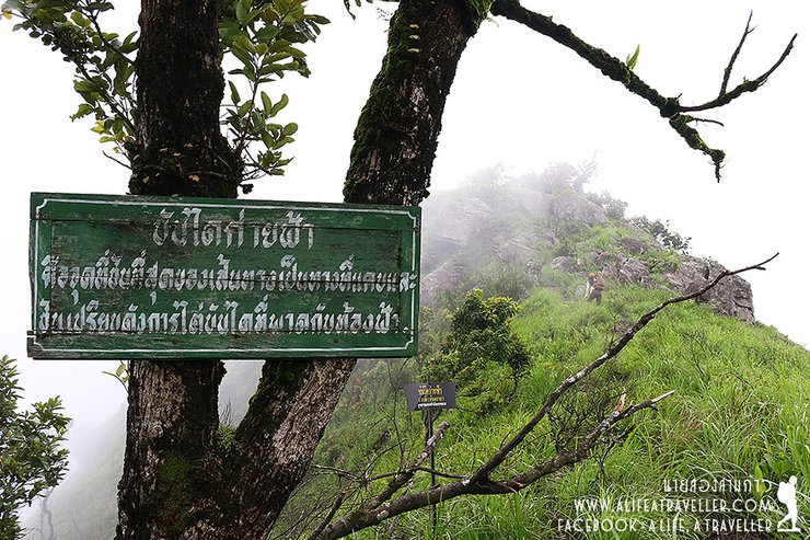
Yet, I'm not disappointed as the cloudy mist gives us another good atmosphere. P' Look Hab are also very optimistic as they said it's good that the mist is spreading around now as when we reach the top of Doi Luang, the sky would open.
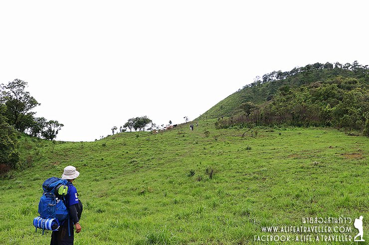
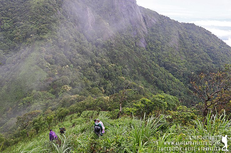
We keep walking up until around 11 a.m. the National Park staff is our guide tells us that......the previous walk was just an appetizer, now we are going for the main course. From now on, the road will be doubled steep and we must walk across 4 mountains: the first one in front of us is "San Moo Mae Dong", the second one is "Den Sa Kaeng", the third one is "Ban Dai Kai Fah", and the last one which is the one we want to conquer is the highest point of Phayao "Doi Luang".
Ok...when we are ready for this, let's go!!!
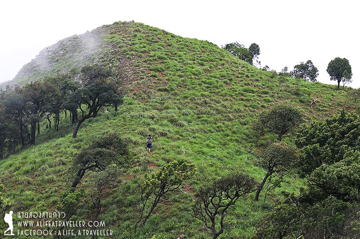
We start from the San Moo Mae Dong. Moo Mae (pig's mother) must refer to pig's mother who raise her kids until she's very skinny. Let's think about how would the spine of skinny pig look like?....It's very steep and narrow!

My big backpack keeps pulling me back but I finally made it. Usually when we are on the San Moo Mae Dong, we will see Lampang on the left side and Lamphun to the right. But what we see now is just the white mist all over the place. Look Hab recommend us trying to put our weight on the right side because it's easier to pick us up if we fell, but if we fell on the left, it's a long way down and they would have difficult time picking us up (haha).
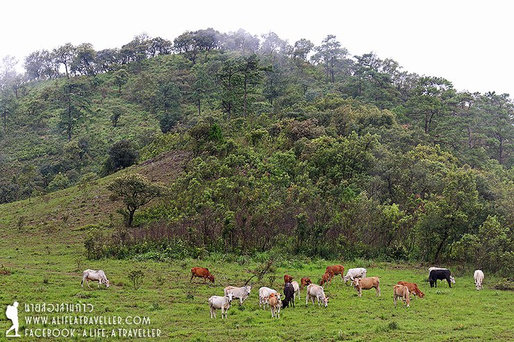
We hike through the whiteness and about 15 minutes to noon we now arrive at the half way, "Deng Sa Kaeng". I heard the bells sound and saw a large herd of cow eating grass around. I'm very curious of where they are from. The staff said they belong to villagers down there. These cows walk up to eat something here.....OMG! these cows are just....amazing.
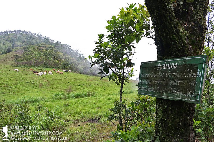
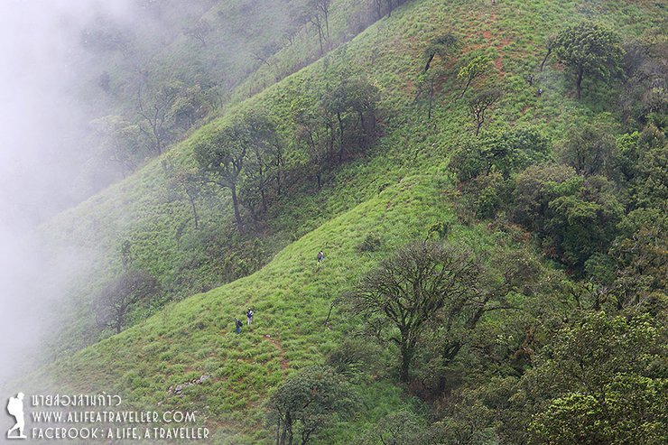
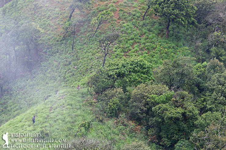
According to Northern language, "Den" means open area while "Sa Kaeng" means lie on one side or lean. Together, Den Saakeng means the open leaning area. But what I see is the not so tall empty mountain which is quite difficult to walk. Possibly, because it has the right angle of leaning and we start to get exhausted, it's very easy to get a cramp when walking across this field. It almost gets to me too but I stand still for couple minutes whenever my leg is stiff so I survived it.
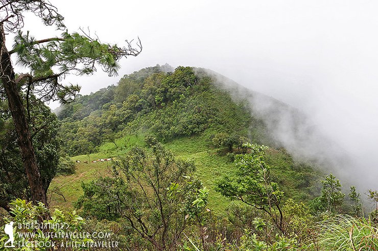
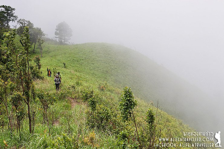
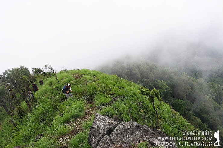
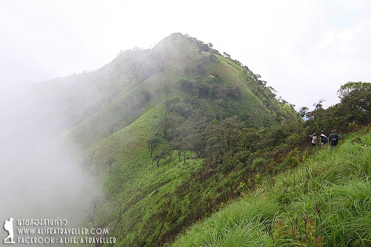
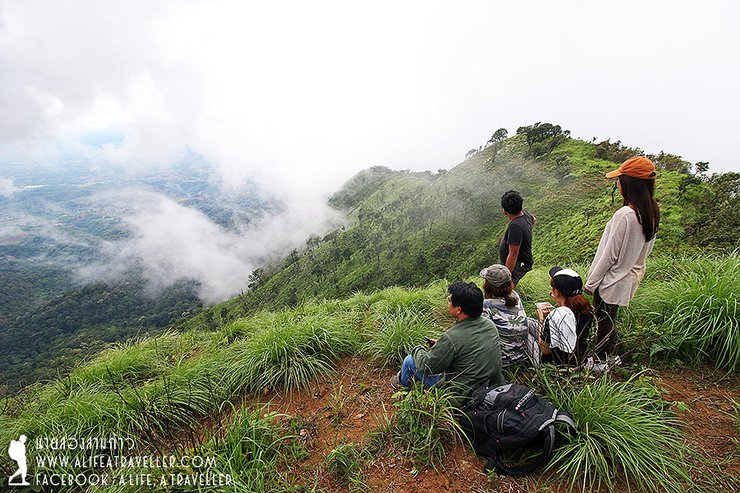
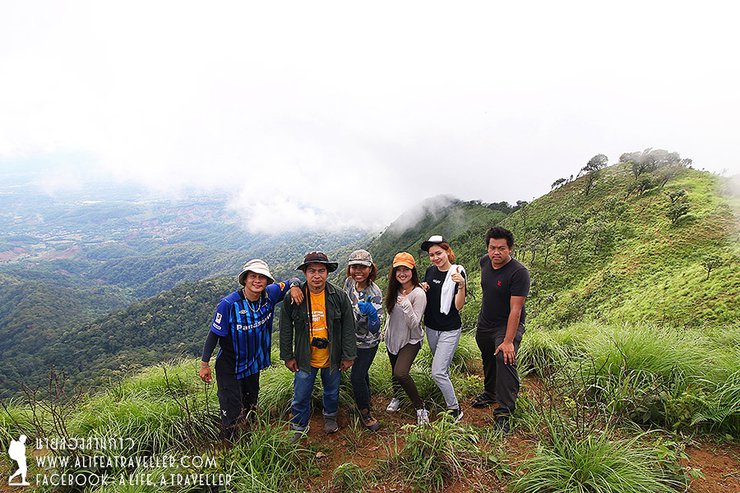
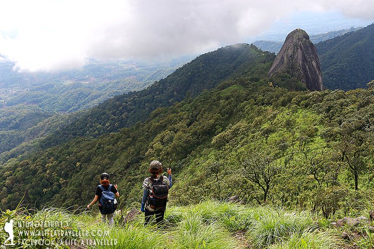
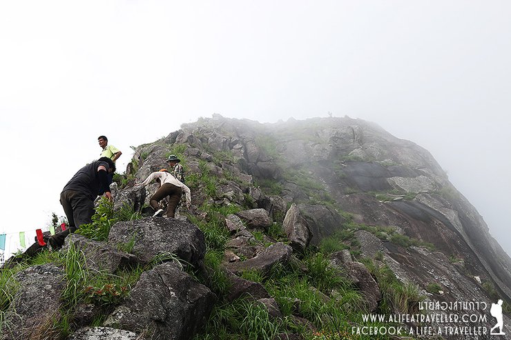
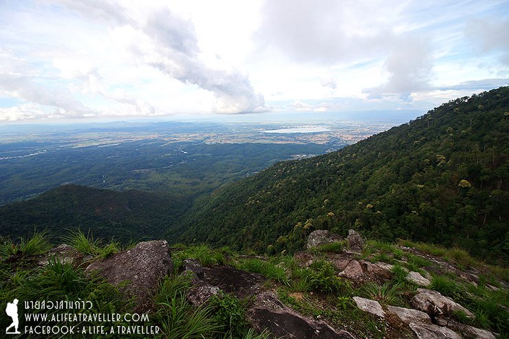
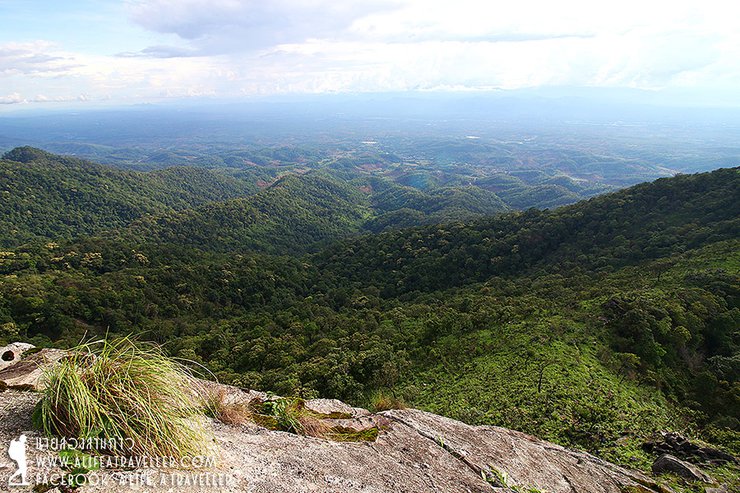
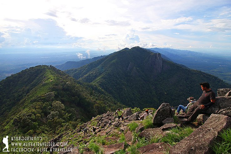
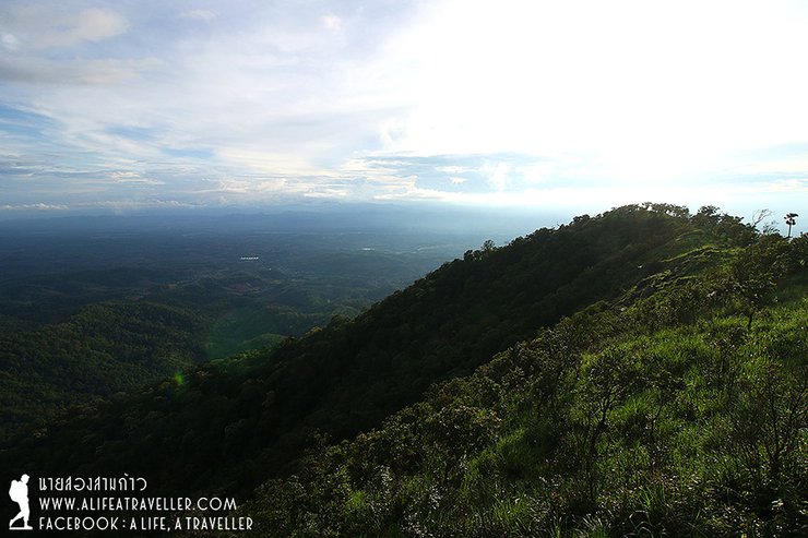
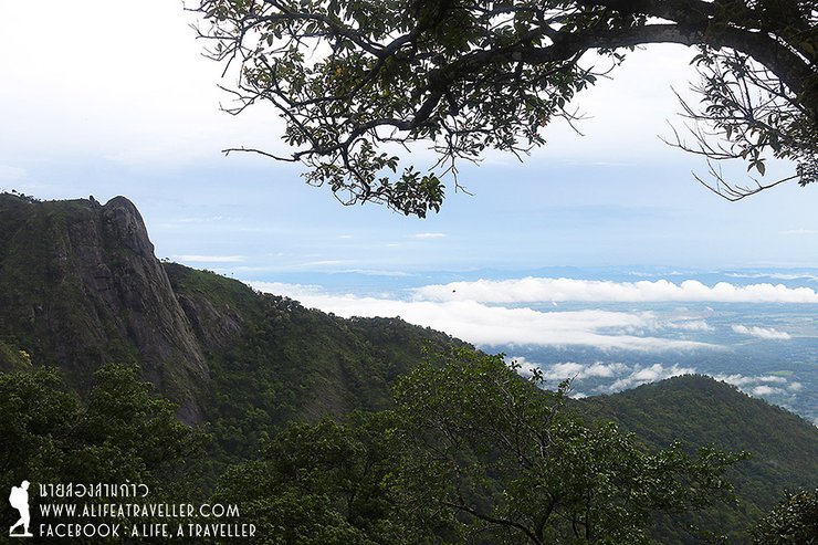
After the Den Sa Kaeng, we now walk on a mountain ridge. Although I still wish for the sky to open so I can clearly see the view below, I'm also quite satisfied with this view of white mist cuddling green forest.
At 13.30 p.m., we arrive at the third mountain, "Ban Dai Kai Fah" (the stairs to the sky). I think we don't need to explain much, we just have to hike up along the rocks. It's not so difficult but very steep.

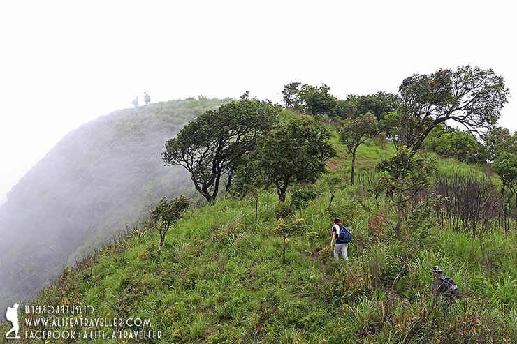
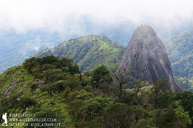
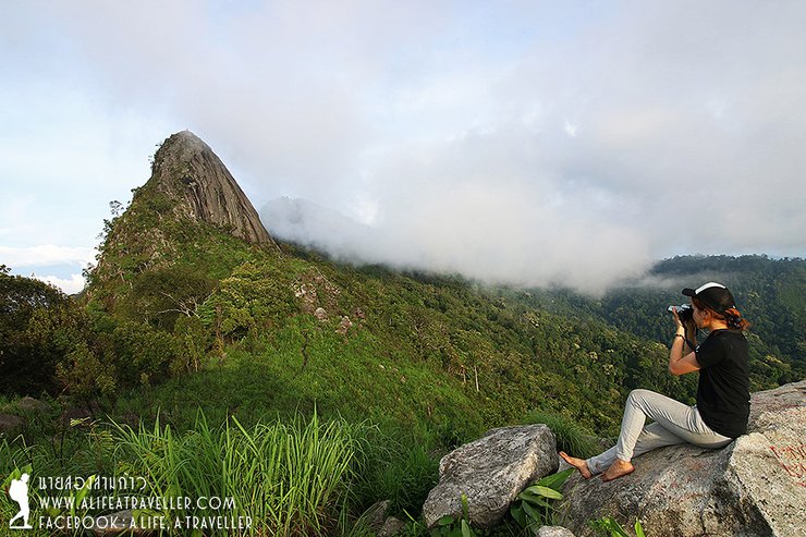
When we walk pass Ban Dai Kai Fah, the highest mountain of Phayao slowly reveals herself to us, it is "Doi Luang". When I see there's a higher chance for the sky to open, I relax and wait for the mist to fade in order to capture Doi Luang from afar. I see my friends are walking up and shrunken; they start to look like ants now.
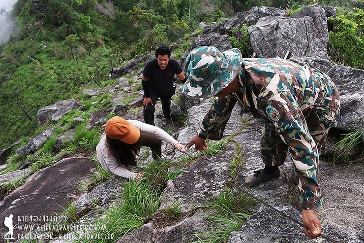
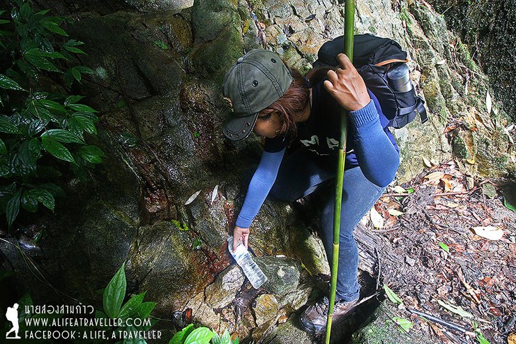
Oh....there's a water pond right before we go up to Doi Luang. It's a natural water and we can drink.
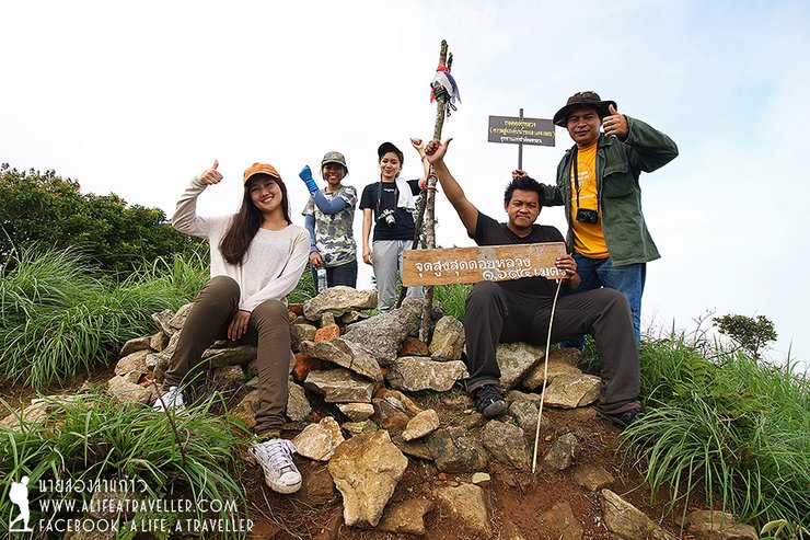
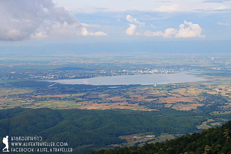
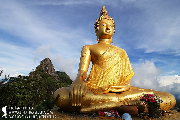
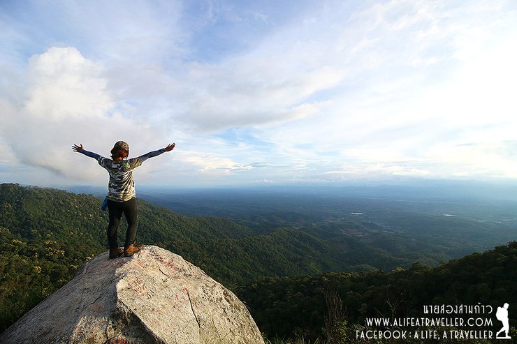
One two three, one two three, step by step, we conquer the top of Doi Luang Phayao which is 1,694 m above the sea level at 15.00 p.m. Very luckily, the mist starts to fade just like what Look Hab have predicted. The view here is from Lampang side.
From the starting point, we now hike for 9 km. Usually if it's a two nights three days trip, we will spend a night on Doi Luang and walk to Doi Nok which is 2 km away the next day. But we are a one night two days trip, we need to continue the walk to the camp at Doi Nok after having some rest.
- Continue to Doi Nok -
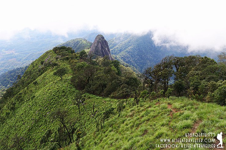
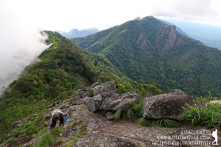
We keep following the ridge while the sky is more open. When the mist disappears, Doi Nok reveals her full self to us. This amazing photo is so great that no explanation is needed. If this is not a great creation of the nature, how can a big rock outstandingly stand in the middle of the forest?
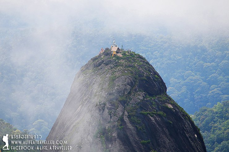
From afar on top of Doi Nok is Phra That Doi Nok. The history said that the original relics have long ages but the builder is unclear. The latest renovation was about 30 years ago. Nowadays, there's a worshiping Phra That Doi Nok tradition annually in every April. Local people will walk up from Ban Huai Mo which is our way down tomorrow.
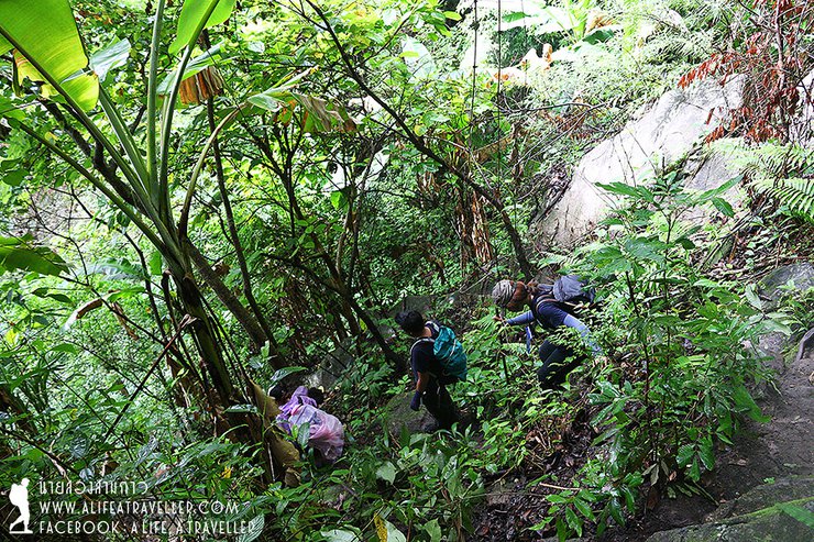
The more steps we take, Doi Nok becomes closer to us. Then, we need to walk down along the rocks in order to climb up onto the other mountain.
We arrive at the foothill of Doi Nok at 16.30 p.m. Then, we leave our bag there. Now we are ready to conquer Doi Nok. I must say that for people who are scared of the height, your legs could be shivering because the way up is very steep. Good thing that the rocks aren't slippery so our shoes can firmly hold onto it.
I can't believe that Doi Nok that we saw from afar, now we conquer it and stand on it. The sky is almost all open as well. This allows us to clearly see the beautiful view. One side is Lampang and the other side is Phayao. If you want to know which side is Phayao.....it's the side that you can see Kwan Phayao!
On the top, in addition to Phra That, we can also pay respect to several Buddha Images.
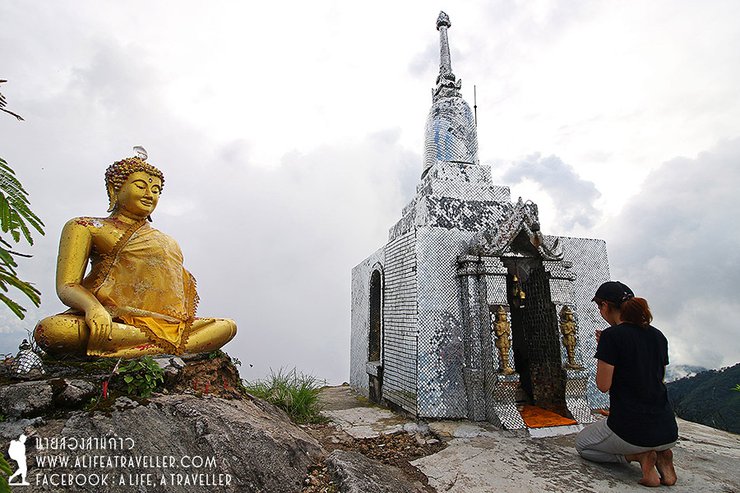
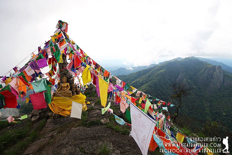
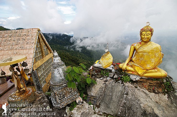
From here, we see the rocky mountain right next to it. Look Hab said it's called Pha Sam Sao. Probably, the route to conquer it would be built in the future. The below, where the golden Buddha is enshrined, is the place we are going to sleep tonight.
The Buddha Image is only 500 m away from the foothill of Doi Nok. Although this is a short distance, our strength has been used a lot so it's a bit struggle. We arrive at the Buddha Image 10 minutes to 18.00 p.m. From the starting point to here is 11 km excluding the way up to Doi Nok, this is a very satisfying timing.
This is the view taken from the Buddha Image area, it's quite beautiful.
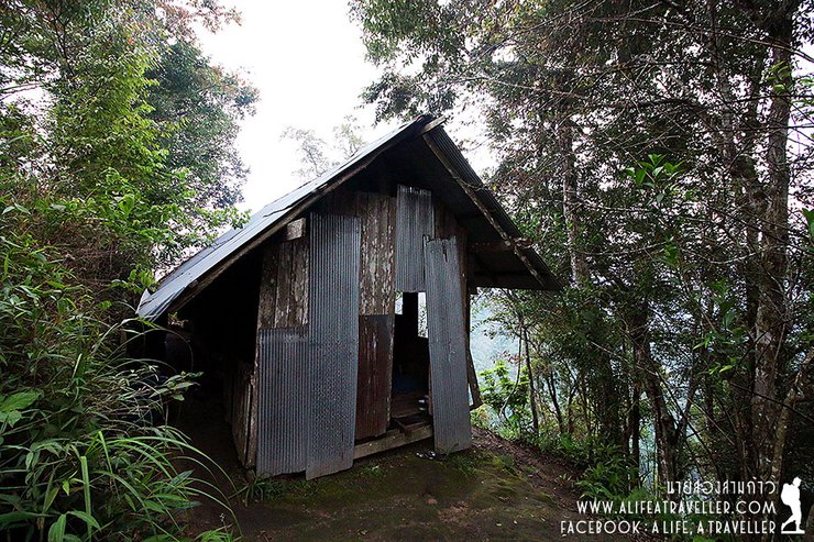
You can tent at the Buddha Image area if you want. On the way down, there's a hut like this. I think staying inside a hut seems to be a better idea on the rainy season. Oh, for the restroom, you need to share it with the nature.
For the dinner, in addition to the instant noodle that we prepared, Look Hab cook rice and banana stalk curry (Kaeng Yuak Gluay). Even if there's no actual drinking water, the rain is kept for us to drink and wash.
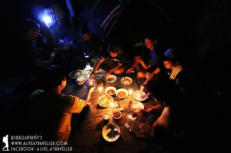
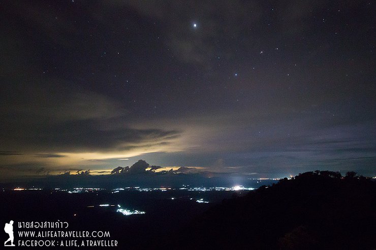
After dinner, I'm walking to take stars shots at the Buddha Image area but it's too cloudy so let's pass it.

I remember it's only a bit after 20.00 p.m. when I slowly fall into sleep mode.
- On the Way Down with Pha Klet Nak Waterfall-
The next morning, we wake up around 7 a.m. to find the rain is hitting our roof. We pack, drink a cup of hot coffee, and eat whatever we still have left in order to make our bag the lightest possible.
When we leave at 8 a.m., the rain is still there so everyone gets to use their raincoats for the first time.
The starting point of the way down is from the Big Buddha Image and we walk along the mountain shoulder. The grass along the way is quite tall, it's recommended to wear gloves to prevent yourself from any scratch. Even the rain is falling, the view along two sides is very beautiful that I can't help but take out my camera to capture it.

The way down is quite steep. There're several points where we need to hold onto the robe and slowly walk down. The rain makes it even more slippery, we take turn to fell down which draws many laughter.
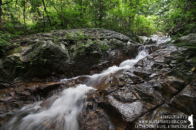
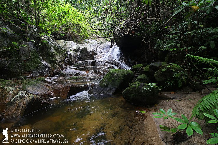
It takes about an hour to keep walking down straight. Then, we arrive at the resting area call "Pha Nang Jub". Water is running down from this cliff and if we want to drink water, we must kiss the rock first (Jub). This originates the name of this cliff. The water comes from the water original place. It's clean and we definitely can drink.
From here, we need to walk along the stream. The waterfall is called Pha Klet Nak, it has 9 layers. We can contact the National Park to ask for the guide to take us to stay over at the top floor. I'll definitely try it out on my next visit.
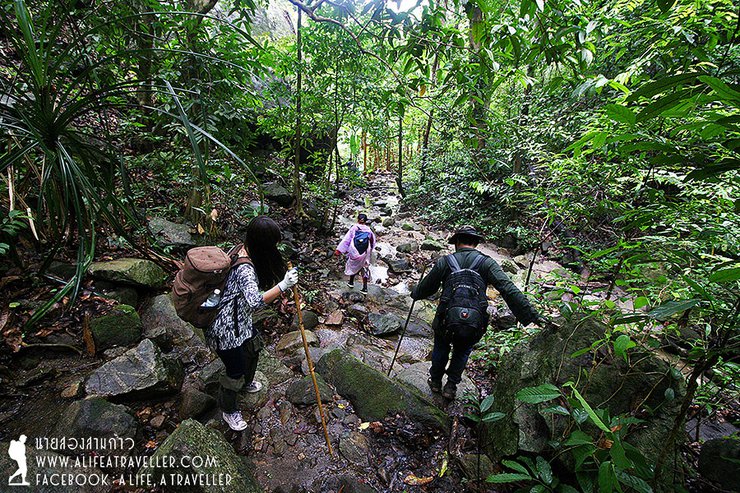
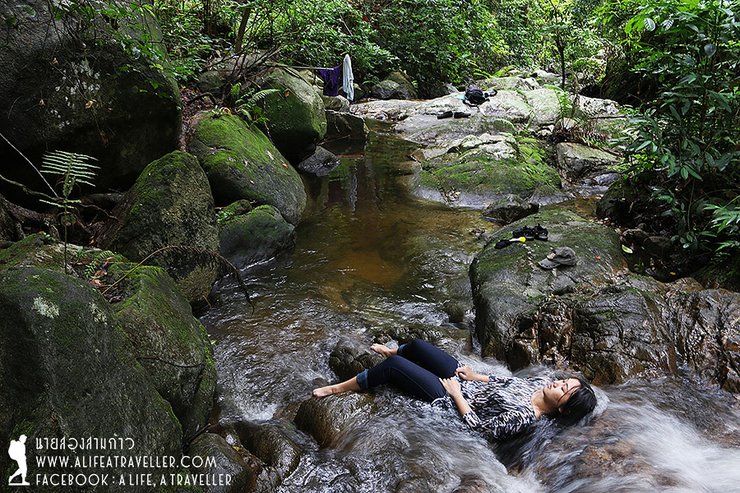
We walk along the steam and stop for lunch at the fourth level of the waterfall called Wang Kang Kao. Many people also play in the water to feel refresh and relax.
Soon after we finish enjoying the steam, the thunder begins. We hurriedly pack our things and about to move on but the rain pours down. The staff told us to hurry and keep moving as the rain now carries the risk of flash flood.
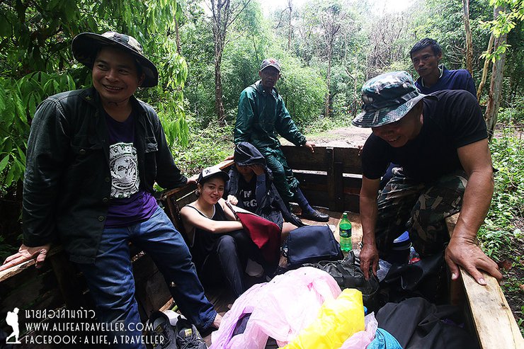
We quickly walk and forget about the tiresome. Soon, the clear steam turns into red. This motivates us to walk even faster. We walk pass the third layer, second layer and reach the first layer at Ban Huai Mo, Ban Tun Sub-district where E-Tan (local truck) is there to pick us up and now the rain also starts to stop.
The time from when we started to walk down at 8 a.m. until our pick up point at 12.30 p.m. is about 3 and a half hours.
E-Tan takes us out of the forest and goes into a village where the National Park staff is there to pick us up with a truck. Then, they take us for lunch and again back to the Forest Protection Unit 6, Jumpathong to take shower before dropping us off at Phayao Bus Terminal.

No one can tell if we will have a chance to travel together, meet again, or even if we will still keep in touch. We have to admit that these two short days only allow us to know one another roughly and we are quite different in age so our actual lifestyle is also quite different.
But even if we'll never meet again, we six people can be sure that we will never forget this memorable trip.
Doi Luang-Doi Nok, 29-30 June 2016 at Phayao Province.
The Preparation of Conquering Doi Luang-Doi Nok
- Food. If we are coming in small group, we don't have to prepare much. We need to contact the National Park to see if Look Hab also prepare food for us as normally they will cook food.
- We just need to bring the sufficient drinking water for hiking up as the water is there to fill up at the tenting area on top of Doi Luang-Doi Nok as well as the steam on the way down.
- At the top of Doi Luang and Doi Nok, it is more suitable for tenting rather than tieing a sleeping cradle as the trees are not so big. Doi Nok has the hut that we can sleep inside.
- Some snails are there from Doi Luang to Doi Nok so we need to prepare although there's only one time that one of our members got sucked by a snail.
- On the way down, grass is quite sharp and it could scratch our hands and body so we should we long sleeve or gloves if possible.
Expenses with the National Park
Please contact the Forest Protection Unit 6, Jumpathong at tel: 092-713-2046, 080-853-6033
- National Park entrance fee is 20 THB per person.
- The tenting fee is 30 THB per person per night.
- The pick up and drop off truck service is 1,600 THB.
(Bus Terminal – Walking up Staring Point – Ban Huai Mo – Forest Protection Uni – Bus Terminal)
- E-Tan pick up and drop off service is 500 THB.
(Walking down Point – Ban Huai Mo)
- Look Hab service is 500 THB per person per day.
- National Park staff tour guide service is 500 THB per person per day.
For our 6 people trip with a National Park staff and two Look Habs, the overall expenses is 5,400 THB.
Please follow more of my travel channels from: http://www.facebook.com/alifeatraveller
นายสองสามก้าว / A Life, A Traveller
Monday, September 5, 2016 11:09 AM